Circling Jamaica: A Six-Day Road Itinerary
A Complete Island Circuit by Car
Driving a full circle around Jamaica is less about mileage and more about terrain. The island measures roughly 398 miles by its major roads, yet completing the loop requires between 14 and 16 hours of driving time with minimal stops. Mountains rise abruptly from plains, coastal roads bend through towns, and river valleys narrow unexpectedly. On paper, the distance is comparable to the drive from New York to Pittsburgh; in practice, it takes considerably longer.
It is possible to complete the circuit in two days, but doing so leaves little room for pauses, detours, or lingering in the places that make the journey worthwhile. A four-day version—overnighting in Port Antonio, Kingston, and Negril—offers more balance, but still compresses the experience. A more measured pace is six days: stopping in Ocho Rios, Port Antonio, Kingston, Treasure Beach, and Negril before returning to Montego Bay. This rhythm allows a full day in each of the major coastal towns and space for the unplanned moments that define road travel.
The itinerary below follows this six-day route. Before setting out, it helps to understand Jamaica’s primary road network, as the character of each road—coastal, inland, elevated, or historic—shapes the journey as much as the destinations themselves. Before embarking, we recommend taking the time to familiarize yourself with the main roads in Jamaica.
Driving around the entire island of Jamaica
Jump to: Day 1 | Day 2 | Day 3| Day 4| Day 5 | Day 6
Each of the legs below highlights several stops worth exploring along the way. It is impractical to do them all with a 6 day roadtrip, so select a couple and plan on approximately 2-3 hours for each.
Day 1 - Montego Bay to Ocho Rios
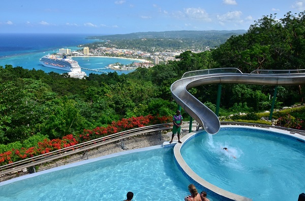
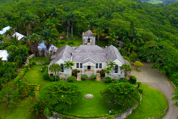
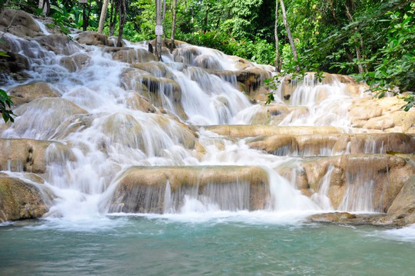
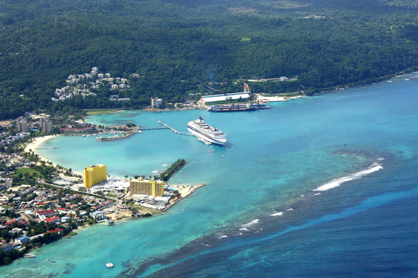
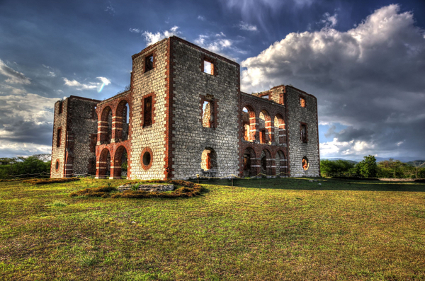
Overnight in Ocho RiosStarting in Montego Bay, head east along the A1 toward Ocho Rios, home to Dunn’s River Falls, one of the most famous tourist destinations on the island. This stretch of road is a well-maintained main artery along Jamaica’s northern coast, lined with expansive resorts on both sides of the highway—many with their own private beaches. This leg of the journey takes you through three parishes: St. James, Trelawny, and St. Ann. Along the way, you skirt Falmouth, the capital of Trelawny and one of the best-preserved Georgian towns in the Caribbean. Many late 18th- and early 19th-century buildings still stand today. In its heyday, Falmouth was called the “Paris of the Western Hemisphere,” a reflection of the wealth and infrastructure generated by its role as a central trading hub for sugar. The wealth concentrated along Jamaica’s north coast during this era was staggering. Vast sugar plantations, worked by enslaved Africans, supported opulent Great Houses built for their owners. Discovery Bay is the next major town as you enter St. Ann Parish. It is named for what is believed to be the place where Christopher Columbus first landed in Jamaica. The town is home to Columbus Park, an open-air museum featuring Columbian and colonial artifacts. From there, the coastal route passes through Runaway Bay, a name whose origin remains uncertain. One theory suggests it refers to Spanish soldiers fleeing advancing English forces in the 1600s. Another claims it commemorates enslaved people who escaped the plantations and attempted to flee to Cuba. As you approach Ocho Rios, the landscape begins to tighten and the traffic builds. At Mammee Bay, a major roundabout marks an important junction: here the North–South Highway branches inland toward Kingston, placing the capital just over an hour away. It is a modern artery that has dramatically shortened cross-island travel and reshaped how accessible the north coast has become. Continuing straight, the road tracks the coast, soon reaching Dunn’s River Falls—Jamaica’s iconic cascading waterfall—and Mystic Mountain, home to zip-lining and the rainforest bobsled ride inspired by Jamaica’s Olympic team. From there, it is only a short stretch into the heart of the bustling resort town of Ocho Rios. |
Day 2 - Ocho Rios to Port Antonio
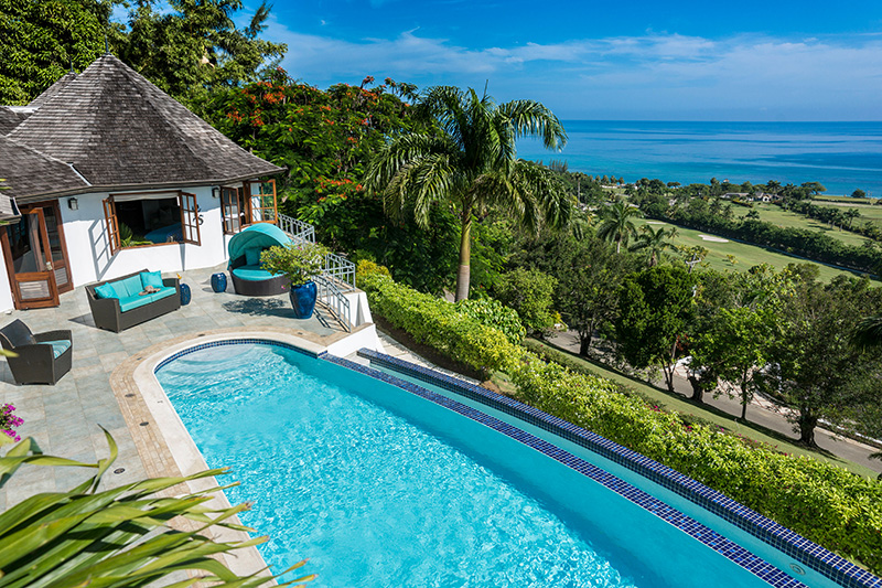
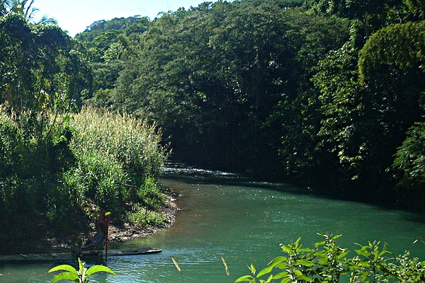
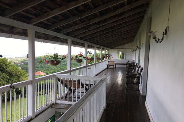
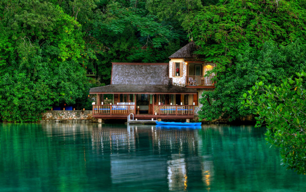
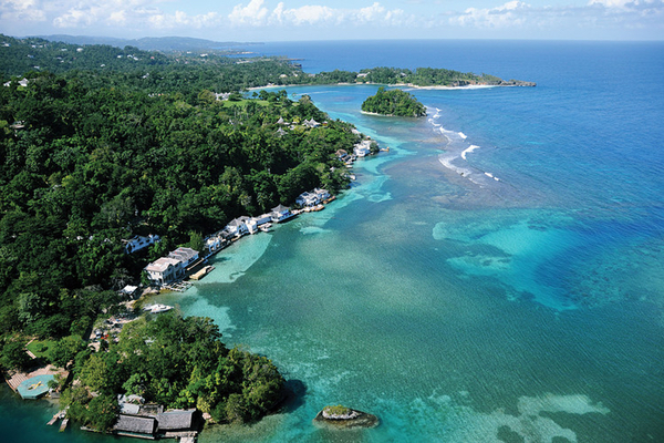
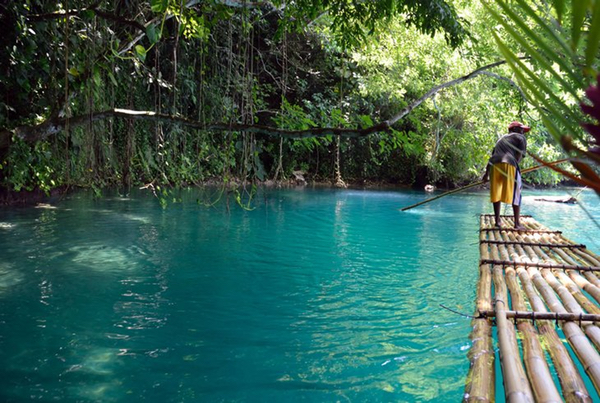
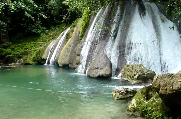
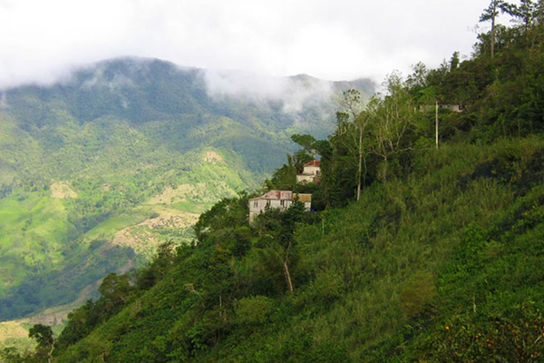
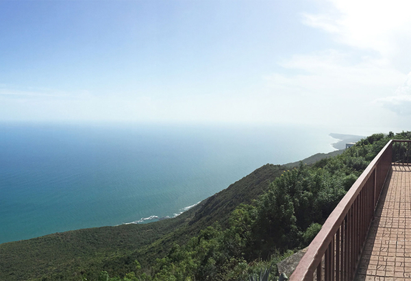
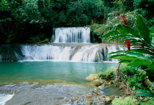
Overnight in Port AntonioContinue east from Ocho Rios along the A3. The road climbs gently into the hills of St. Mary, passing through Oracabessa and by GoldenEye—the former home of Ian Fleming, where he wrote the James Bond novels. Today, the property operates as an exclusive 52-acre resort with a private beach and lagoon. Sting famously wrote “Every Breath You Take” while staying there. If time permits, a short detour inland at Galina leads uphill to Firefly, the former home of Noël Coward. Now a small museum, it offers sweeping views across the coastlines of St. Mary and Portland and a quiet glimpse into the artistic circle that once gathered here. The drive then descends toward Port Maria, the capital of St. Mary, perched above the coastline with sweeping ocean views. Small and unhurried, the town hugs the sea before the road continues eastward through pockets of farmland and banana groves. Just before reaching Annotto Bay, a roundabout marks the junction of the A3 and A4. Take the first exit onto the A4, which continues east along the coast toward Port Antonio; the second exit heads south on the A3 through the island’s mountainous interior toward Kingston. From here, the road traces the shoreline more closely. After crossing into the parish of Portland, Buff Bay is the next major town. A secondary road—the B1—branches inland from Buff Bay, climbing into the Blue Mountains toward Kingston. It is one of the island’s most beautiful mountain drives, but also one of its most unpredictable, as heavy rains frequently trigger landslides that can close sections without warning (see Driving the B1 through Blue Mountains National Park). Continuing east, the landscape becomes noticeably greener. Port Antonio, the capital of Portland, sits on Jamaica’s windward coast at the foot of the Blue Mountains—the highest mountain range in Jamaica and among the highest in the Caribbean. Much of this region forms part of the Blue and John Crow Mountains National Park, designated a UNESCO World Heritage Site in 2015 for its ecological richness and deep Maroon cultural history. Portland receives some of the highest rainfall totals on the island, and the result is a deep, layered green: rainforest-covered hills, river valleys, and a coastline broken by coves and cliffs. (see Blue & John Crow Mountains). Port Antonio remains largely outside the main tourism circuit. The pace is slower, nightlife minimal, and the appeal lies in immersion—sea, river, and mountain in close proximity. The town has its own small airstrip and has long attracted discreet foreign investment. The Errol Flynn Marina is named for the British actor who settled here in the 1940s. Flynn popularized bamboo rafting on the Rio Grande, transforming what had once been a method of transporting bananas downstream into a leisure experience that endures today. Most hotels and villas are located east of town along the five-mile coastal stretch toward San San. In this enclave, private estates and high-end properties are tucked into the hills or perched on cliffs above sheltered coves. |
Day 3 - Port Antonio to Kingston
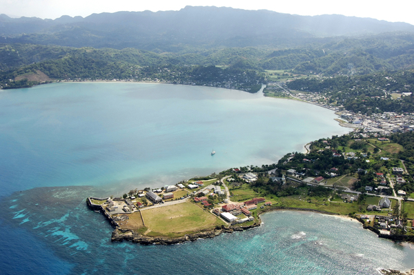
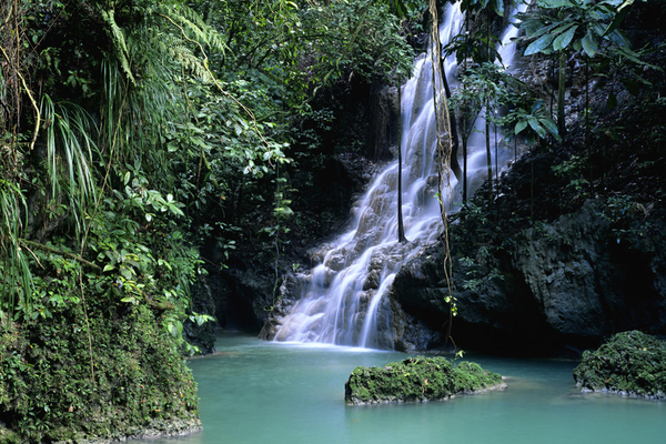
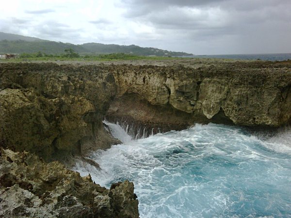
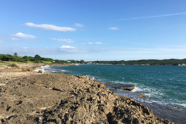
Overnight in KingstonContinuing east from Port Antonio along the A4 takes you through Boston Bay, widely regarded as the birthplace of Jamaican jerk pork—a style of seasoning and open-pit barbecue developed by the Maroons, blending African spice traditions with indigenous Taíno barbacoa-style cooking over pimento wood fires in the mountains. Stopping to sample it here is almost obligatory; the emphasis remains on pimento wood smoke and open-pit technique rather than modern variations. From Boston Bay, the road rises gently above the water while continuing to hug the coast. It curves southeast through Manchioneal and past the turnoff to Reach Falls, a secluded series of waterfalls tucked into the rainforest. Soon after, you cross into the parish of St. Thomas Parish, approaching the easternmost tip of the island. The coastline along this stretch is rugged and dramatic—rocky outcrops, restless surf, and waves that crash against the cliffs, sometimes sending spray onto the road itself. St. Thomas remains one of the least developed parishes in Jamaica. Its windward position exposes it to heavy rainfall and weather systems moving in from the Caribbean Sea. Combined with steep terrain and runoff from the Blue Mountains, erosion has historically made road maintenance challenging. In recent years, major upgrades to the Southern Coastal Highway have significantly improved sections of the A4, widening and stabilizing the route; however, the parish’s geography and climate still demand constant upkeep. Tourism traffic along this corridor—from Port Antonio to Kingston via St. Thomas—remains lighter than along much of the island’s north coast, and the pace of life reflects that quieter rhythm. The parish also carries deep historical weight. Morant Bay, the parish capital, was the site of the Morant Bay Rebellion. In October 1865, protesters gathered outside the courthouse to voice grievances over economic hardship and political exclusion. Confrontation escalated; the courthouse was burned, and several officials were killed. Martial law followed. Paul Bogle, the Baptist deacon who led the march, was executed. George William Gordon, a politician accused of supporting the uprising, was court-martialed and also executed. A statue of Bogle stands in front of the courthouse ruins, which remain a stark reminder of the rebellion’s consequences. Continuing westward, the drive eventually reaches Bull Bay in the parish of St. Andrew before entering Kingston. The road passes the narrow spit of land that forms the Palisadoes, the peninsula on which Port Royal and Norman Manley International Airport are located. Kingston is Jamaica’s capital and, together with neighboring St. Andrew, forms the country’s largest metropolitan area under the Kingston and St. Andrew Municipal Corporation (KSAMC). Built around one of the Caribbean’s great natural harbors, it remains central to the island’s political, cultural, and commercial life. Often bypassed by resort-focused tourism, the city rewards those who venture beyond the coast. Nearby Port Royal was once the largest and most economically significant English settlement in the Americas—known in the 17th century as the “richest and wickedest city in the world.” In 1692, a devastating earthquake sank much of the town beneath the sea at the height of the piracy era. In July 2025, Port Royal’s archaeological ensemble was inscribed on the UNESCO World Heritage List, recognizing its exceptional historical and cultural significance. |
Day 4 - Kingston to Treasure Beach
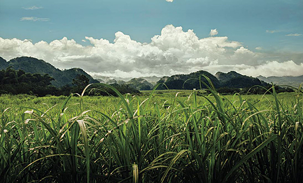
Overnight in Treasure BeachThe southern coastline of the island is generally less developed, and this leg of the journey heads west through Jamaica’s southern interior plains. The drive from Kingston to Treasure Beach begins with a choice: the modern tolled east–west corridor (Highway 2000, commonly referred to as the T1) or the older A2. The tolled highway now runs from Kingston through Spanish Town and May Pen to Williamsfield near Manchester, significantly reducing travel time across the southern plains. Toll plazas are located at Spanish Town, Vineyards, May Pen, and Toll Gate. Drivers using the toll road will exit at Williamsfield (or earlier at May Pen) to join the A2 for the remainder of the journey toward the south coast. Both routes pass through wide, open terrain once dominated by sugar cane, the island’s principal cash crop during the height of the plantation era. This stretch crosses four parishes—St. Catherine, Clarendon, Manchester, and eastern St. Elizabeth. The first two are largely flat and expansive, offering long horizons and an unhurried landscape. The tolled highway is fast and efficient but bypasses most towns. Using the A2 from Kingston instead brings you first to Spanish Town, Jamaica’s former capital until 1872. From there, the road continues through agricultural countryside to Old Harbour and on to May Pen, the capital of Clarendon. Beyond May Pen, the route gradually climbs into the cooler highlands of Manchester, skirting Mandeville before descending sharply through Spur Tree into the parish of St. Elizabeth, where the landscape opens again as you approach the coast. Treasure Beach lies off the main highways and requires leaving the primary road network for narrower hillside routes. Rather than a single town, it is a string of small fishing villages and coves stretched along the southern shoreline. Life here moves at a slower pace. The setting is quiet, understated, and largely outside the mainstream tourism circuit—well suited to travelers seeking the simplicity of Jamaica’s seaside communities. The choice between the toll road and the local road ultimately comes down to pace and preference: efficiency and speed on the modern highway, or a slower drive shaped by towns, farmland, and the everyday rhythms of southern Jamaica. |
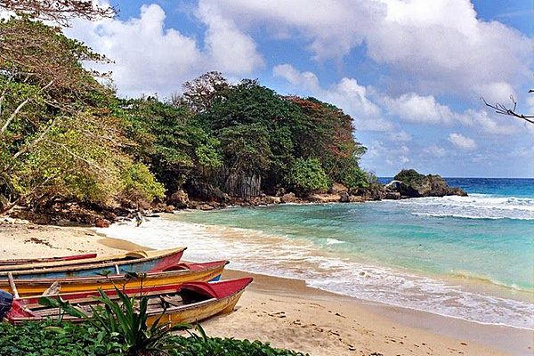
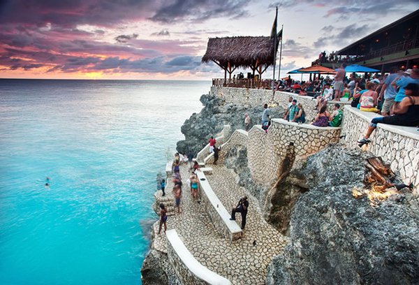
Day 5 - Treasure Beach to Negril
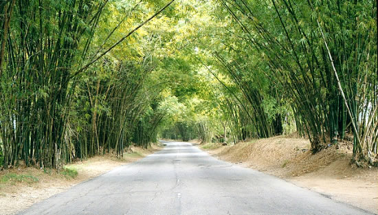
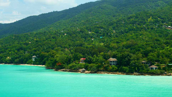
Overnight in NegrilThe journey from Treasure Beach to Negril crosses two parishes: the remaining portion of St. Elizabeth and into Westmoreland. Leaving Treasure Beach, narrow hillside roads reconnect you with the A2, which then carries you north before bending west toward Negril. This leg is scenic, particularly along Bamboo Avenue—a stretch of the A2 lined on both sides with tall bamboo forming a shaded canopy over the road. Much of this region is flat and was once dominated by sugar cane during the plantation era. The Appleton Estate, a working sugar estate and rum distillery, is located inland along the B6. The A2 eventually reaches Black River, the capital of St. Elizabeth. Situated at the mouth of Jamaica’s second longest river, it was once one of the island’s most important commercial ports. Its prosperity led to several early distinctions: Black River became the first town in Jamaica to be supplied with electricity in 1893 and among the first to introduce motor vehicles and telephone service. From Black River, the road stays relatively close to the coastline as it enters Westmoreland, passing through Whitehall and on to Bluefields, the birthplace of Peter Tosh, founding member of Bob Marley and the Wailers and later a prominent solo reggae artist. Bluefields sits where the mountains descend sharply to the sea, creating a lush, dramatic setting. At the border of St. Elizabeth and Westmoreland lies Scott’s Cove—commonly called “Border”—where the road widens and roadside cookshops serve fried fish, chicken, and conch soup to passing motorists. Stops like this offer an unfiltered glimpse of rural coastal Jamaica. The drive continues west to Savanna-la-Mar, the capital of Westmoreland, often shortened to “Sav.” Established during the Spanish period, it remains a commercial center on the island’s southwest coast. From there, the route progresses toward Negril, known for its long stretch of white sand beach and dramatic western-facing cliffs. Negril is well developed, with large resorts, smaller boutique properties, and popular cliffside establishments such as Rick’s Café, famous for its sunset views over the Caribbean Sea. Off the coast near Negril in 1720, the pirate William “Calico Jack” Rackham was captured by the British Navy. Among his crew were Anne Bonny and Mary Read, two women who had disguised themselves as men while serving aboard his ship. According to accounts of the capture, most of the crew were intoxicated when surprised by Captain Jonathan Barnet’s sloop, and only Bonny and Read are said to have resisted before their eventual arrest. In late October 2025, Hurricane Melissa — a rare Category 5 hurricane that made landfall on Jamaica’s south coast — caused catastrophic damage along the southern corridor. Black River and the surrounding communities took the brunt of the storm, with homes, historic buildings, and infrastructure severely damaged or destroyed, and the famed bamboo canopy along Bamboo Avenue was flattened, prompting emergency crews to clear the road for access and relief efforts. The region’s recovery has been ongoing as local authorities and residents rebuild after one of the most powerful storms to strike the island.
|
Day 6 - Negril to Montego Bay
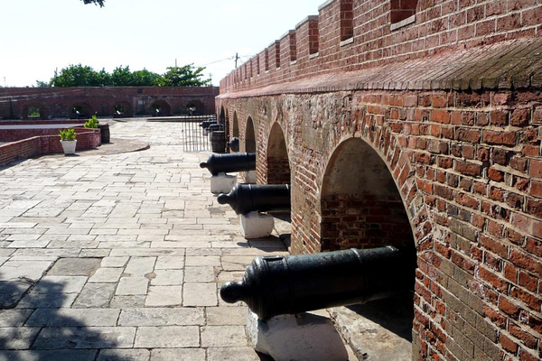
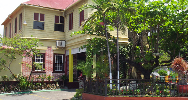
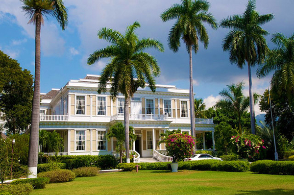
Overnight in Montego BayThis leg of the journey follows the coastline north toward Montego Bay, crossing three parishes: Westmoreland, Hanover, and back into St. James, where the journey began. It does not take long after leaving Negril to enter Hanover; the Negril strip itself spans both parishes, with development continuing along sections of the shoreline. Much of this northeastern stretch is shaped by a series of coves—large enough that, while driving, it is not immediately obvious the road is tracing broad semicircles along the coast. The route passes through Lucea, the capital of Hanover, situated along the wide sweep of Tom Pipers Bay, almost due north of Savanna-la-Mar. The B9 provides a direct inland connection between the two towns across the mountains. Fort Charlotte, built by the British in the 18th century, stands at the mouth of the bay and is traditionally said to have been linked by tunnel to the nearby Hanover Parish Church. The Hanover Museum, housed in a former jail dating to the late 18th century, displays artifacts that trace the town’s colonial history. Further east lies Tryall, a historic estate encompassing roughly 2,200 acres and home to one of Jamaica’s remaining Great Houses from the plantation era. Today it operates as a private resort and golf community. Continuing east, the road crosses into St. James near the mouth of Great River Bay, where the Great River empties into the Caribbean Sea. This stretch is marked by lush vegetation rising into the surrounding hills. The river, popular for rafting and tubing, winds between Hanover and St. James before flowing from its headwaters in St. Elizabeth. Over six days, the drive circles the island through mountains, plains, fishing villages, historic ports, and modern resort towns. Each parish carries its own rhythm, shaped by geography and history. Returning to Montego Bay, the route completes a full loop—revealing an island far more varied and layered than any single destination can suggest. |