Driving through the Blue Mountains
via the B1 Road
This drive from Papine to Buff Bay is arguably the most scenic route on the island. It climbs into Jamaica’s highest ranges, where the views come in layers—mountain ridgelines, tucked-away waterfalls, deep rainforest, and coffee country. Much of the journey runs through the Blue and John Crow Mountains National Park, inscribed as a UNESCO World Heritage Site in 2015 for its outstanding natural and cultural value.
It’s a route worth doing whether you’re visiting or you’ve lived here all your life. Many Jamaicans still haven’t driven it end to end, which is part of the appeal. Take your time, make stops, and do the full crossing at least once—the road captures the island’s mountain character better than any other.
Journey Time and Road Conditions
The journey takes about 2 1/2 hrs non-stop, but allow 3-4 hours for a leisurely drive with stops to enjoy the sights, landmarks and attractions along the way.
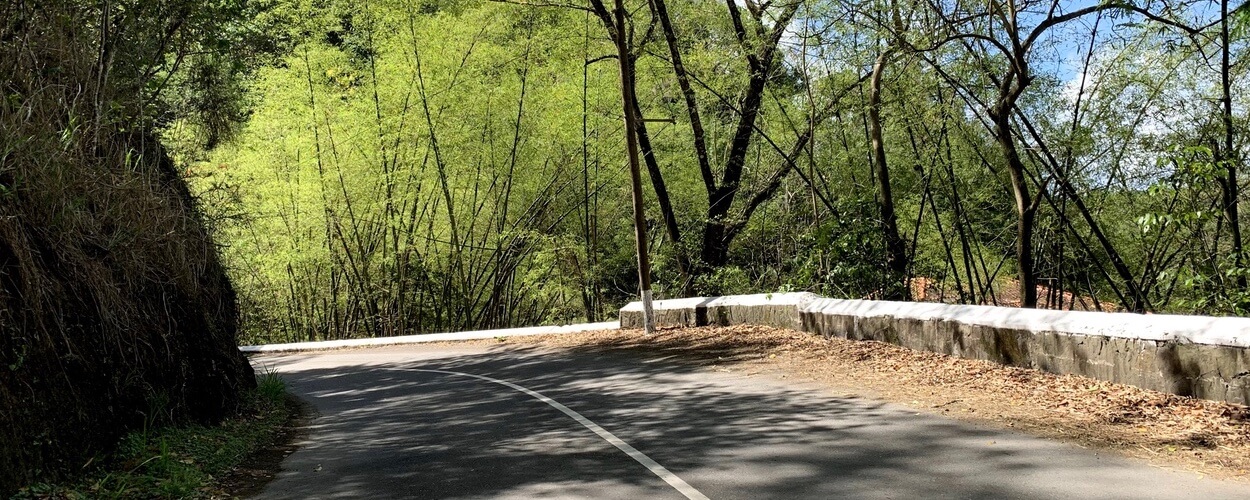
A 4-wheel drive car is not a requirement. A regular car should do it. The road is narrow in most places, so slow down and take your time. The road is in general in reasonable condition, but there are spots with deep ruts and potholes from heavy rains. Portland is known for high rainfall, making the route susceptible to landslides and water-flow damage.
The route was unpredictable in previous years with long periods of closure. While it has been more stable recently, it is still a good idea to stop in Irish Town or Newcastle and ask locals if the path to Buff Bay is open. The worst case is a U-turn, but the drive itself is always worth it.
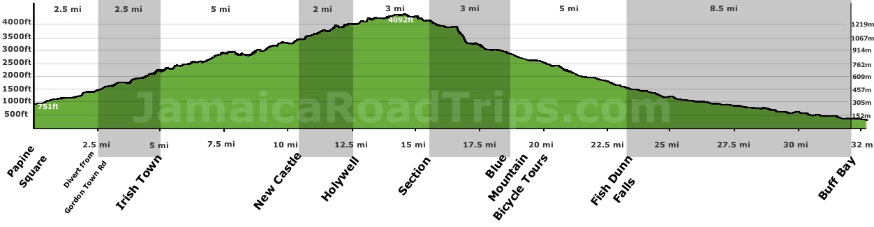
Route Elevation: Papine to Buff Bay
Scrollable Profile
The B1: From the Bustle of Papine to the Irish Town Ridge
The journey starts in Papine, a bustling market square in Kingston close to the University of the West Indies. Within minutes, the urban energy is left behind as the road winds northward, hugging the banks of the Hope River. About two miles in, the road reaches the Cooperage .
At this junction, the B1 turns left toward Newcastle, while the Gordon Town Road continues right toward Mavis Bank. The area takes its name from the 19th-century Irish coopers who lived in nearby Irish Town . These tradesmen crafted the wooden barrels essential for exporting Jamaica’s rum and coffee. Potatoes remain an important local crop today, reflecting that early Irish influence.
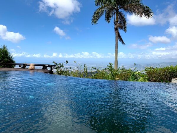
Today, Irish Town is most famous for Strawberry Hill, an exclusive resort known as a retreat for artists like U2, Sting, and Bob Marley. The property features a distinctive "creole" feel and offers expansive views stretching to the Caribbean Sea. Stopping here for a meal or coffee is highly recommended for the atmosphere alone.
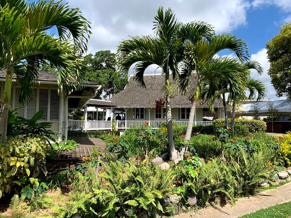
Strawberry Hill Grounds
Creole Architecture
Just beyond Strawberry Hill lies the community of Redlight, named for the 19th-century brothels that once entertained the Irish coopers. The area is dotted with local rum shops and hiking trails through coffee plantations, offering sudden, beautiful views overlooking the Liguanea plains.
Newcastle: A Military Station in the Clouds
From Redlight, the road negotiates steep hairpin turns as it climbs to Newcastle . Established in 1841 at 3,500ft, it served as a mountain station for British soldiers to escape the tropical diseases of the lowlands.
The road passes directly through the parade ground of the Jamaica Defence Force training center. On a clear day, the views over Kingston are unmatched. Opposite the camp, Catherine's Peak towers in the mist, named after Lady Catherine Long, who is reputed to have been the first woman to climb it in 1760.
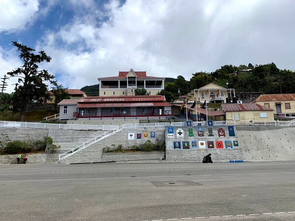
Main Building in Newcastle
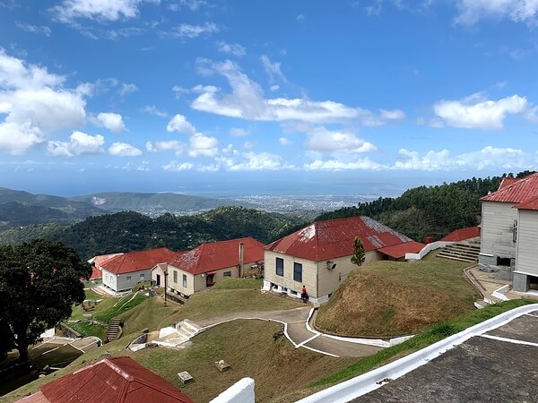
Terraced Barracks
Various Irish regiments, such as the Earl of Ulsters and the Royal Inniskillings, were billeted here. The military legacy even persists in the Jamaican Constabulary; the iconic red stripes on their trousers were patterned after the Royal Irish Constabulary.
Navigation and Coffee Culture at Section
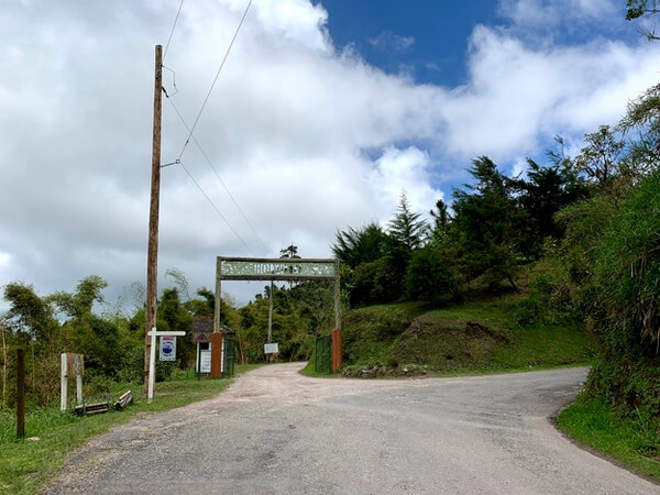
From Newcastle the road meanders between St Andrew and Portland parishes finally decisively entering Portland just before Hardwar Gap, a hamlet named after a British army captain who was responsible for the road from here to Buff bay. A small mountain-side cafe and restaurant called the Gap Cafe is the only notable structure in the area. It was built as a way station for carrages and travellers on horseback in the 1930s. Just beyond the Gap Cafe is Holywell National Recreation Park , a 300-acre park that is often shrouded in mist, part of the greater Blue and John Crow Mountains National Park.
B1 continues past Holywell
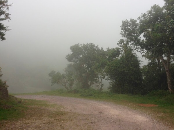
Mist over the Recreation Park
Holywell National Recreation Park serves as a lush sanctuary for endemic species like the streamertail hummingbird (Doctor Bird), Jamaican Tody, and Yellow-billed Parrot, while hosting migratory birds from the north. The park is well-equipped for stays, offering campsites and cabins with kitchenettes, hot water, and Wi-Fi (bookings: 1-876-960-2848/9). Its trail system includes the Oatley Mountain Trail, a 3/4-mile trek through mossy fern forests with panoramic views of St. Andrew and Portland, and a trail leading to a 15-foot cascading waterfall with a swimmable pool.
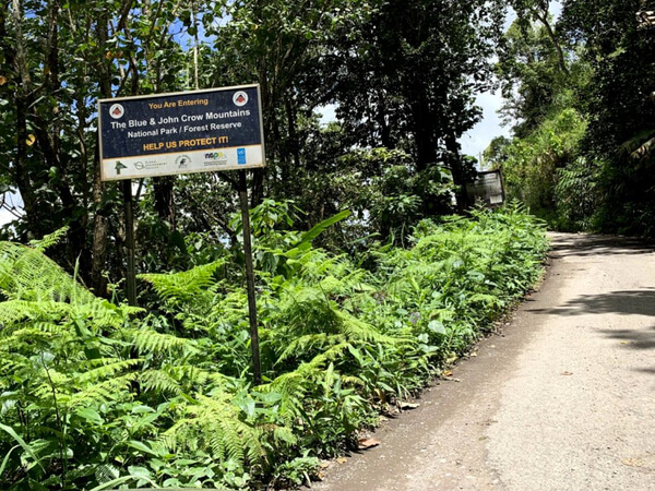
Beyond Holywell, the B1 enters the sparsely populated heart of the UNESCO-listed Blue and John Crow Mountains National Park. This stretch is rugged and unpredictable, often requiring local advice on road conditions before proceeding toward the north coast.
Section: The Coffee Heart
Roughly three miles past Holywell lies Section , a settlement centered on coffee cultivation. Following a historic hurricane that washed away the original B1, a paved path through the private Old Tavern Coffee Estate—run by the Tyman family—now reconnects the route. Here, travelers are often met by locals selling fresh coffee directly from the source.
The Final Descent: Waterfalls and "Donkey Pee Pee" Trees
The descent features breathtaking forestry across 101,313 acres of protected terrain. Three miles from Section, the Blue Mountains Bicycle Tours restaurant sits on a dramatic 180-degree switchback, its building perched precipitously over the valley.
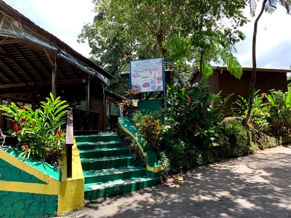
Bicycle Tours Coffee Shop
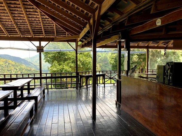
Overlooking the road below
Five miles further, near the hamlet of Muelleth Hall, is the secluded Fish Dunn Falls . Named for the legend that its base is the furthest upstream fish with scales can be found, the falls offer a beautiful pool for swimming. To find it, look for the Avocat Primary School sign and turn left before the white Silver Hill bridge.
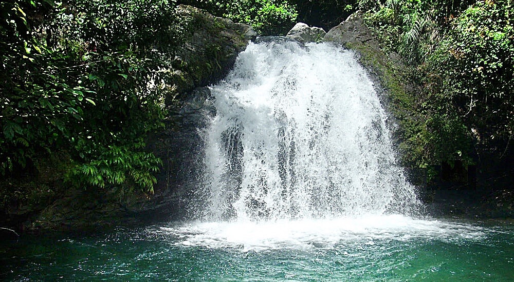
Fish Dunn Waterfalls
The final 8.5 miles to Buff Bay are defined by the "Flame of the Forest" trees—locally called Donkey Pee Pee trees. When in season, their large red flowers spray the green hillsides with brilliant color. The journey resolves at the Caribbean shores of Buff Bay.
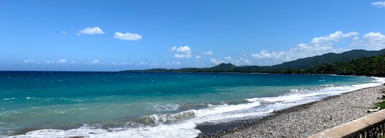
Your reward: The shores of Buff Bay
The End of the Journey
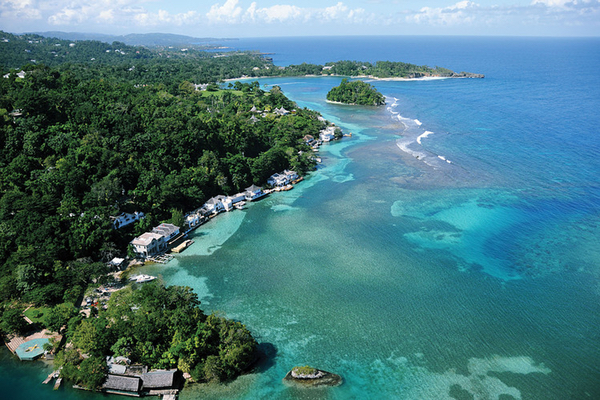
From Buff Bay, you can return to Kingston via the A3 (approx. 1.5 hours) or head 45 minutes east to the scenic coastline of Port Antonio.
Port Antonio - 45 mins east of Buff Bay
Port Antonio is one of the most beautiful parts of Jamaica where the foothills of the Blue Mountain range kisses the Caribbean sea.