1967 Road Map of Jamaica
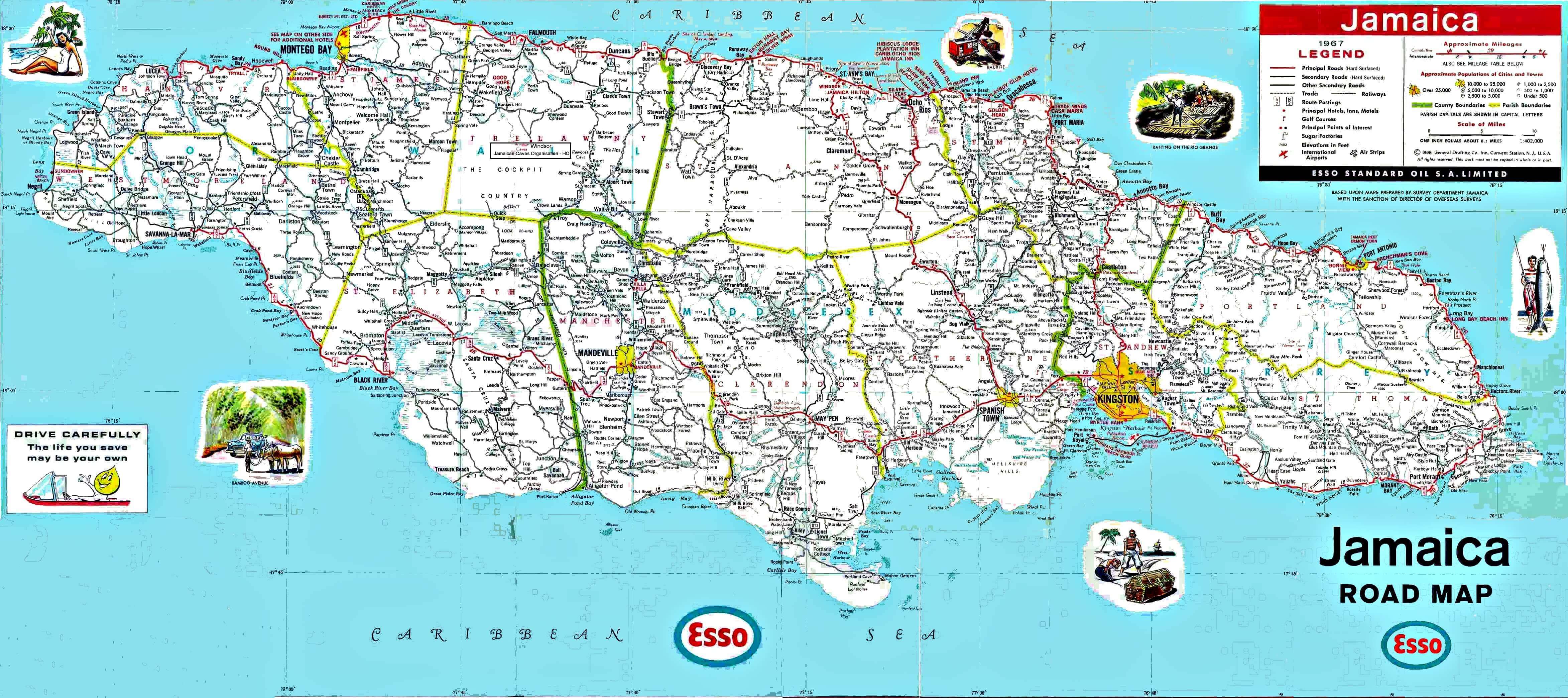
p>The following zoomable map is a scanned image of an Esso 1967 map of Jamaica. The map provides a lot more detail―roads, towns, villages and many small settlements in deep rural districts―than what is shown on current online maps such as Google maps.Click on the image to open window on desktop computers, then zoom in up to 10,000%. A quick reference table of distances between major towns in Jamaica is provided here.